The Great Ocean Road, Victoria: Traveling the Great Ocean Road
I have a weird relationship with the great ocean road. I have visited a couple of times and both times have been cold and rainy. It is my fault for going in winter of course, but it has soured me a little on the road. I now live in Victoria, and my main goal is to rekindle my relationship with Australia's most famous stretch of road.
The Great Ocean Road was conceptualized at the end of the First World War by William Calder. He saw the road as an opportunity to connect the small settlements along the coast to other major roads, as these were previously only accessible by boat or rough bush tracks. William Calder also realized that this would be a fantastic way to supply jobs to roughly 3000 returning service members and requested funding from the War Department. By these veterans it was appointed as a Memorial for those that had fallen during the 1st World war and is considered the world's largest War Memorial.
Construction began in 1919. The men working the road primarily used hand tools and explosives to carve into the rock and dense shrub, working at a pace of 3km a month. An impressive feet considering this was all being done with pickaxes and some dynamite. The first section from Eastern View to Lorne opened in 1922. The road was in most section only wide enough to fit 1 car with pullover lanes few and far between, and was to be paid for by road users with a 2 or 10 shilling fee depending on if you were in a motorcar or a wagon with 2 horses. The road was opened in 1932 when the section between Apollo Bay and Lorne was completed.

Port Fairy Lighthouse
Last year I embarked on a 2-month road trip down the east coast of Australia. I finally reached the great ocean road on the cusp of winter. Even though we were still technically in Autumn I think Victoria thought we had made it to the heart of winter leading to my hands being numb for an entire week. I had been looking forward to this leg of the trip for an entire month and planned to drive the road from Port Fairy (not technically part of the great ocean road but in the same area) to Torquay over 4 days. I arrived in Port Fairy late in the day as I had stopped in at the Grampians for a hike during the day, and I regret not exploring the town a little more. I did a walk around Griffith Island and was accompanied by a rainbow the entire time. I love Lighthouses as a photographic subject, they create such a lovely story just by existing. I feel as though Lighthouses symbolise loneliness a little bit, especially in some of the photos I captured here, and at this point in my trip I was feeling quite alone. I took some time to reflect on my trip and appreciate the opportunity that I had to embark on a trip so grand.
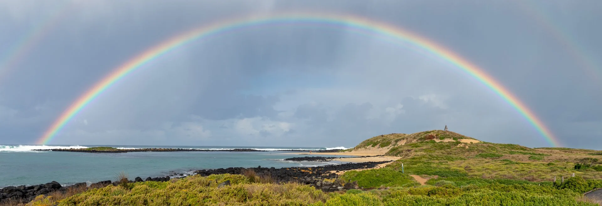
Rainbow on Griffith Island
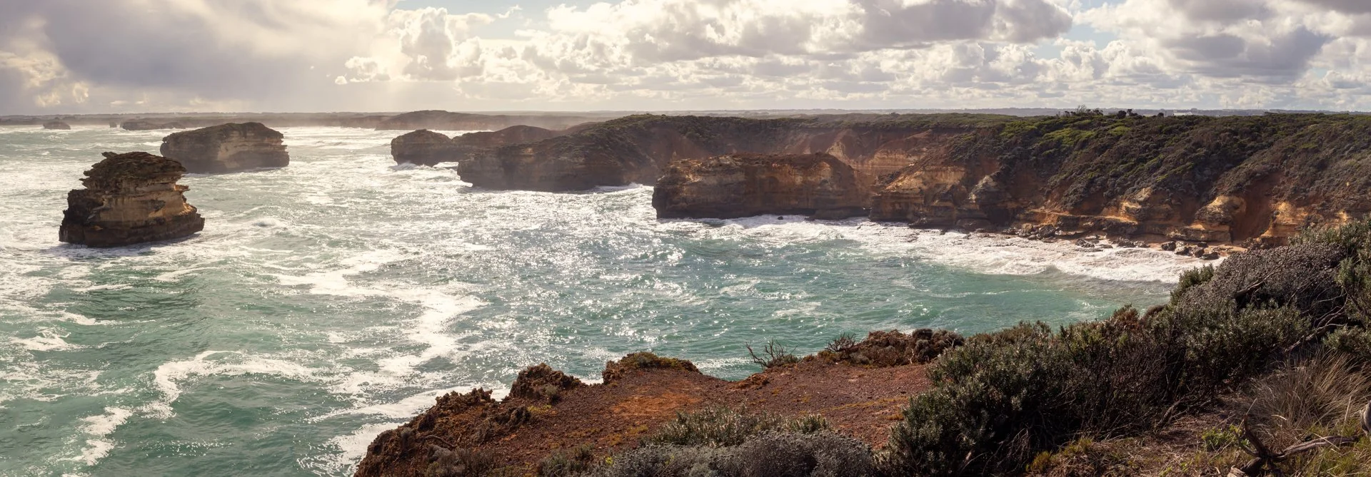
From Port Fairy it was on to Port Campbell. The first leg of this trip is interesting. Once you get to Warrnambool you enter this very rural world, the highway goes inland away from the coast. Suddenly, you hit Bay of Islands and are greeted by the great cliffs and ocean views that the road is known for. There were 2 real standout locations on this stretch of the trip, The Grotto and London Bridge. The Grotto is a hole where waves come crashing in, simple but beautiful. London Bridge is a massive island with an Arch through the middle of it. I stayed at the Port Campbell NRMA Campground, which was packed considering the temperature and distinct lack of traffic I was encountering on the roads. The campsite was positioned in this little pocket next to a large hilly cliff (lots of these in this region) and a beach (same as these).
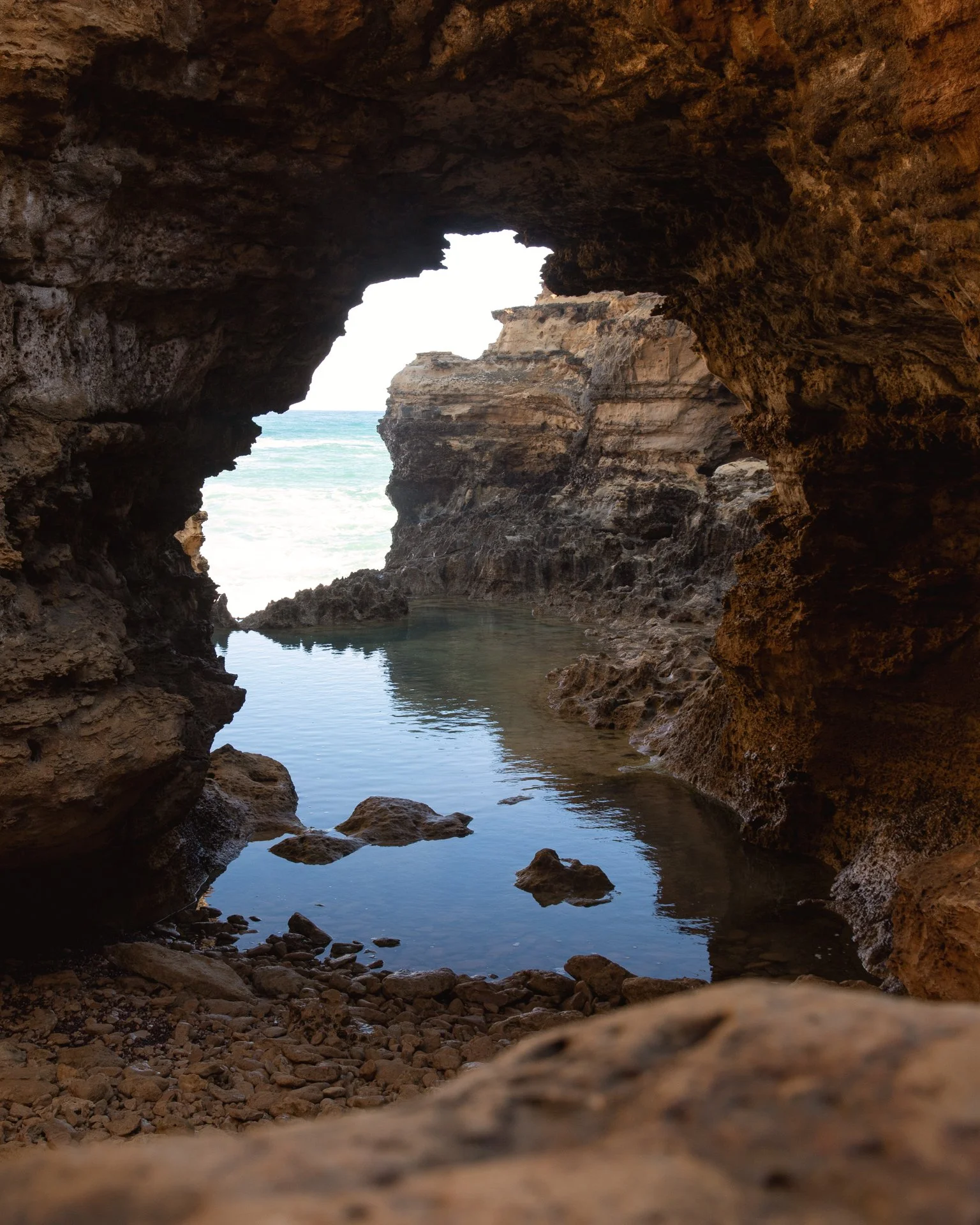
The Inside of the Grotto
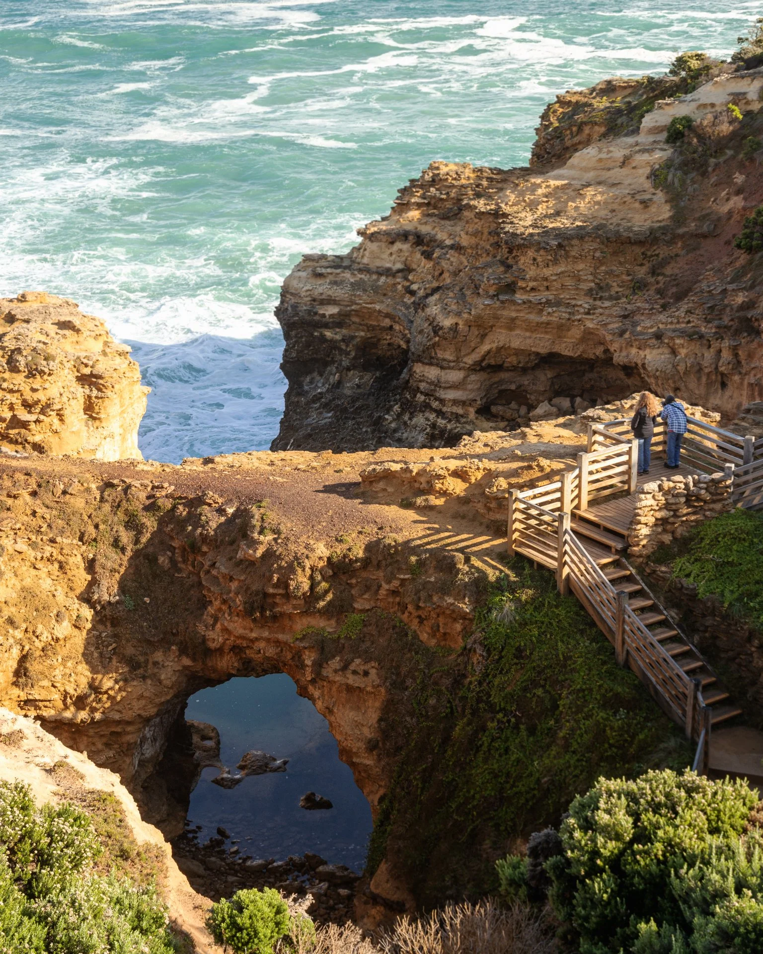
The Grotto from above
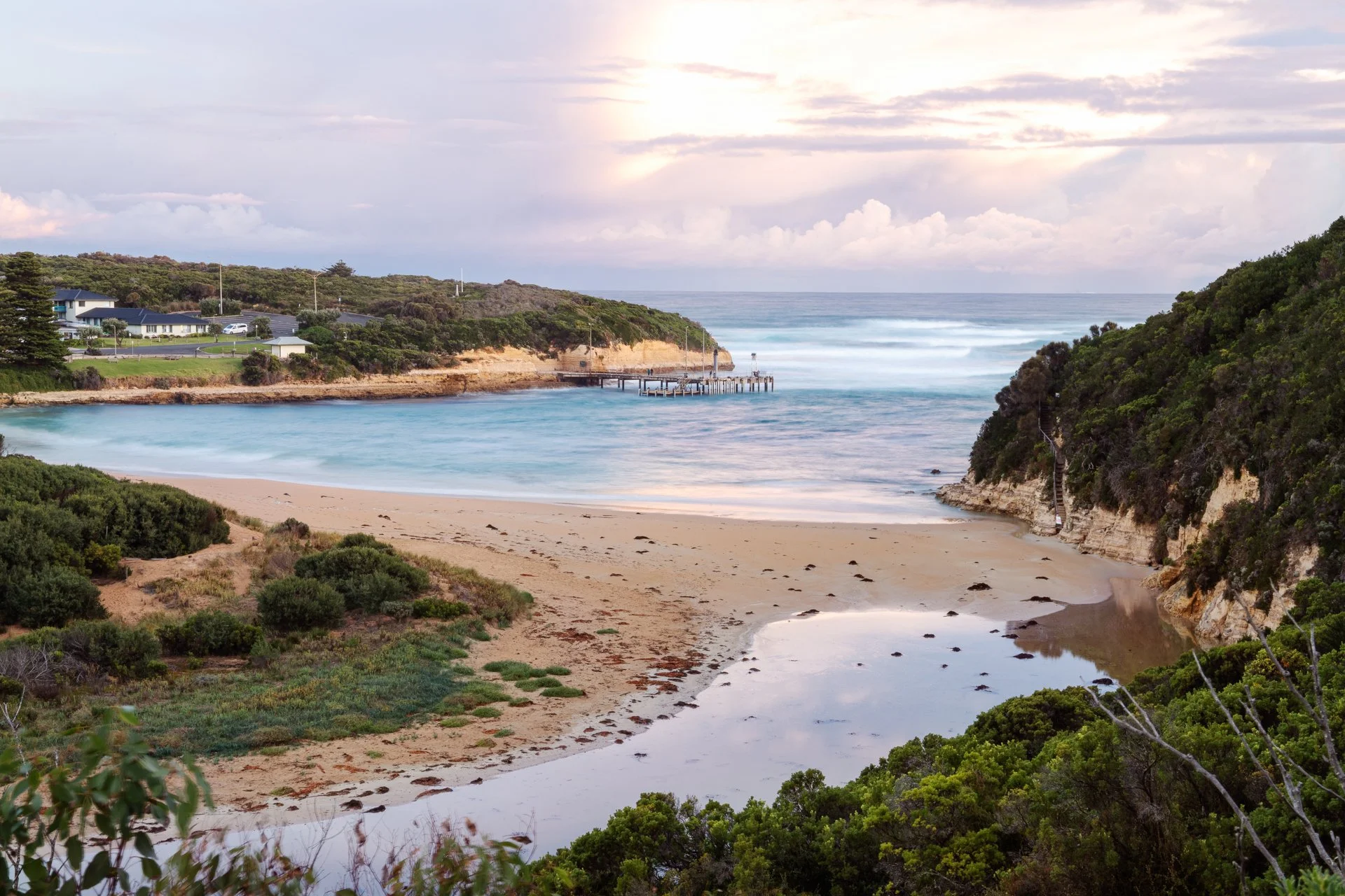
A part of Port Campbell from a lookout near the NRMA Campground
My next drive took me to the twelve apostles. I got to the lookout, took a few pics, and then the rain came and hit hard! I left. I had Cape Otway to check out! Driving this road in the rain is a little less exciting than in the Sun, but I still enjoyed going through the more rainforesty sections during rain. Cape Otway is cool. It is a little historical style village featuring a lighthouse you can climb to the top of (magnificent views of the surrounding cliffs here) and all the communication buildings. Fun fact, the first telegraph line between Victoria and Tasmania was set up here. It failed within 6 months of setting it up and became a method of tracking ships moving past the cape.

I stayed in Appolo Bay for the night, opting to stay in a small motel on the beach rather than my van as the rain fall had increased and all my things were wet. When you are in Appolo Bay make sure you checkout the Apollo Bay Bakery They have a Cheeseburger Pie that was really over the top and delicious. Finally, it was on to Torquay, the end of the Great Ocean Road. I grabbed a coffee and hopped back into the van. I made a quick detour through Beech Forest hoping to find a few waterfalls. I am dumb and almost bogged myself by going down a 4WD only road, in my Front Wheel Drive Van During Heavy, HEAVY rain. I did not find the waterfalls. The last part of the Great Ocean Road to Torquay is a little more civilized. There are towns like Lorne that are a bit more built up and touristy, which kind of loses the charm of the more western parts of the road. This was an exhausting 3 days that made for some photos that I am happy with and a few memories that I will never forget. I am excited for my next trip, especially now that I live in Melbourne!

Caves on the beach at Loch Ard Gorge
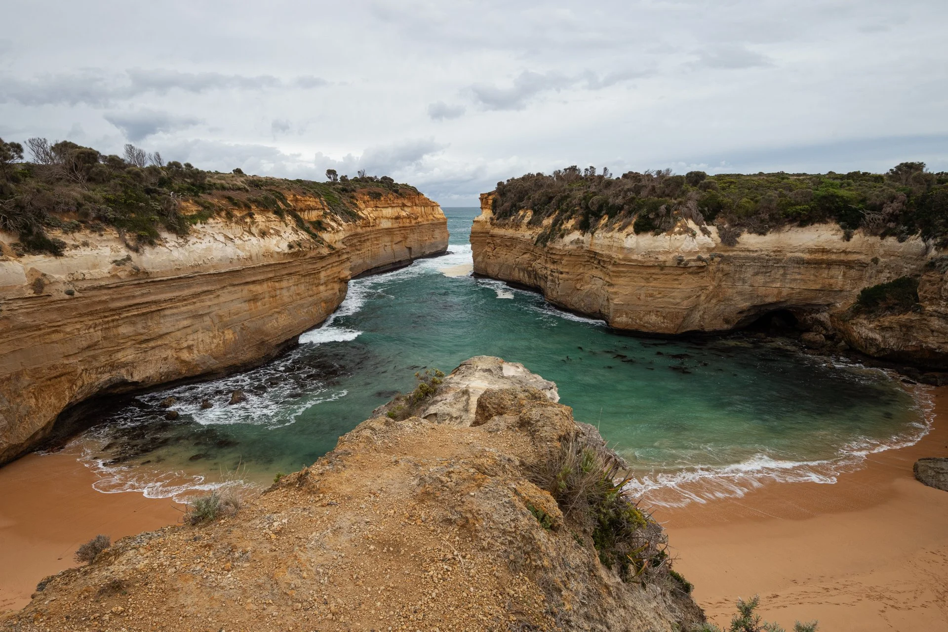
Loch Ard Gorge from the lookout
Thanks for reading my brief history of the Great Ocean Road and about my time Travelling on it!